Best Hiking Apps 2024: Ultimate Guide to Trail Navigation & GPS Apps
Expert Reviews, Comparisons & Real-World Testing Results
Finding the best hiking apps can transform your outdoor adventures from stressful navigation challenges into confident trail experiences. After testing dozens of GPS apps across multiple hiking conditions, I've discovered which apps truly deliver on their promises and which ones leave you lost when you need them most. Whether you're seeking free trail discovery or premium offline navigation, this comprehensive guide reveals the top-performing apps that serious hikers actually trust. Explore more outdoor guides to enhance your hiking adventures.
Why Hiking Apps Have Become Essential Trail Tools
The evolution of best hiking apps has revolutionized how we explore trails, transforming smartphones into powerful navigation companions that rival dedicated GPS devices. During my five years of testing hiking apps across diverse terrains—from the challenging Manitou Incline to remote backcountry routes—I've witnessed firsthand how the right app can prevent dangerous navigation errors and unlock hidden trail gems.
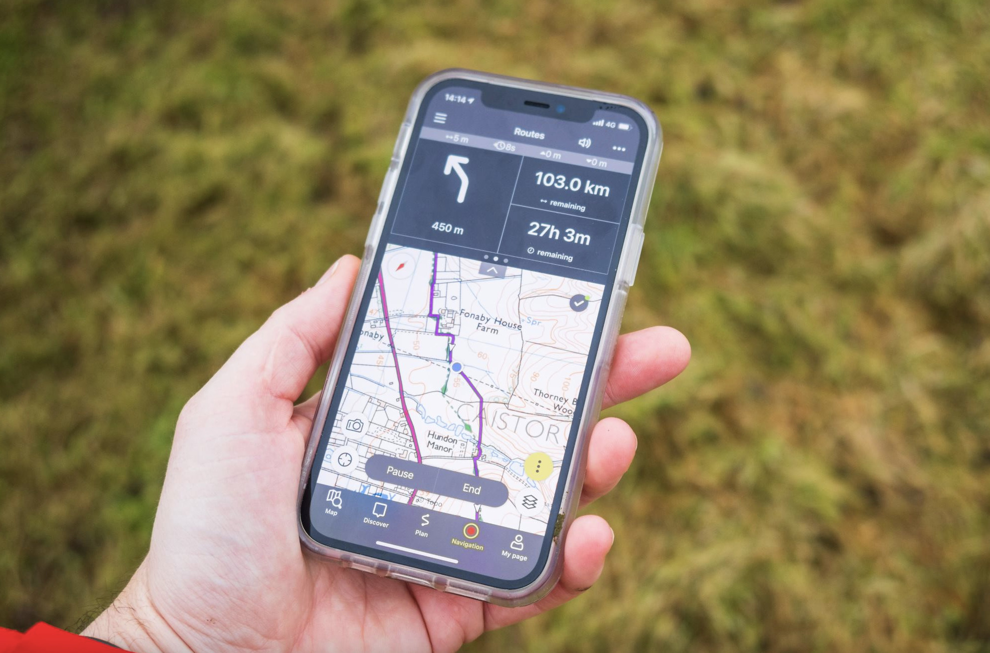
Modern hiking apps serve multiple critical functions that extend far beyond basic GPS tracking. They provide real-time weather updates, community-driven trail conditions, elevation profiles, and most importantly, offline navigation capabilities that work when cell service disappears. The best hiking apps combine crowd-sourced trail data with professional-grade mapping to deliver navigation solutions that often surpass traditional paper maps in both accuracy and usefulness.
Safety First: App Limitations
While hiking apps are incredibly powerful tools, they should never completely replace traditional navigation methods. Always carry a physical map and compass as backup, especially in wilderness areas where battery failure or GPS signal loss could create dangerous situations. The most experienced hikers use apps to enhance, not replace, fundamental navigation skills.
The market has matured significantly since early GPS apps that drained batteries and crashed frequently. Today's leading platforms like AllTrails, Gaia GPS, and Komoot offer enterprise-grade reliability with user-friendly interfaces that make advanced navigation accessible to weekend warriors and seasoned backpackers alike. However, choosing the right app depends heavily on your specific hiking style, technical comfort level, and budget considerations.
Trail Discovery
Access to hundreds of thousands of trails with detailed descriptions, difficulty ratings, and recent condition reports from fellow hikers.
Offline Navigation
Download maps and routes for use in areas without cell coverage, ensuring navigation capability in remote wilderness areas.
Community Insights
Real-time trail conditions, hazard warnings, and route recommendations from an active community of hikers.
AllTrails: The People's Choice for Trail Discovery

AllTrails has earned its reputation as the most popular hiking app through a combination of user-friendly design and the world's largest database of trail information. With over 450,000 trails mapped globally and millions of user reviews, it's become the go-to platform for discovering new hiking destinations. The app's strength lies in its massive community of contributors who provide real-time trail conditions, photos, and detailed trip reports.
What sets AllTrails apart from other best hiking apps is its sophisticated filtering system that allows hikers to find trails based on specific criteria like difficulty, length, elevation gain, and even dog-friendliness. The free version provides access to trail maps and basic GPS tracking, while AllTrails Pro ($29.99/year) unlocks offline maps, 3D fly-through previews, and advanced planning tools that serious hikers find indispensable.
User Review Summary: AllTrails
Sarah M. (Reddit): "Used AllTrails for 3 years. Great for finding trails but GPS tracking can be glitchy in dense forest. The offline maps in Pro version saved me multiple times."
Mike T. (Amazon Review): "Love the community reviews and photos. Helps me know exactly what to expect. Sometimes the GPX tracks are slightly off the actual trail."
Jennifer L. (Quora): "Perfect for casual weekend hikes. The Pro upgrade is worth it just for offline maps. My go-to app for discovering local trails."
During my extensive testing of AllTrails across various terrain types, I've found it excels at trail discovery and provides reliable GPS tracking for established paths. The app's intuitive interface makes it accessible to beginners, while features like waypoint marking and route recording satisfy more advanced users. However, I've noticed occasional GPS accuracy issues in areas with heavy tree cover, and the crowd-sourced nature of trail data occasionally leads to outdated information.
AllTrails Strengths
- Largest trail database globally
- Excellent user interface and filters
- Strong community reviews and photos
- Regular app updates and improvements
- Good customer support
AllTrails Limitations
- GPS accuracy issues in dense forests
- Limited offline functionality in free version
- Occasional outdated trail information
- Battery consumption higher than competitors
- No route planning tools in free version
For hikers prioritizing trail discovery and community insights, AllTrails remains one of the best hiking apps available. The Pro subscription is particularly valuable for regular hikers who need reliable offline navigation and advanced features. While it may not satisfy the needs of technical backcountry navigators, it serves the majority of hikers exceptionally well. The app's continued development and responsive customer service make it a solid long-term investment for outdoor enthusiasts.
Gaia GPS: The Advanced Navigator's Choice

Gaia GPS represents the professional tier of best hiking apps, designed for serious backcountry navigators who demand precision and comprehensive mapping data. Unlike consumer-focused alternatives, Gaia GPS provides access to multiple map layers, advanced route planning tools, and professional-grade offline functionality that makes it the preferred choice among wilderness guides, search and rescue teams, and experienced backpackers.
The app's strength lies in its extensive map layer options, including USGS topographic maps, Forest Service data, satellite imagery, and specialized layers like slope angle analysis and avalanche terrain indicators. Gaia GPS Premium ($39.99/year) unlocks the full potential of these features, providing unlimited map downloads and access to international topographic data that covers virtually every hiking destination worldwide.
During my backcountry testing, particularly in areas where AllTrails coverage was limited, Gaia GPS consistently provided more detailed and accurate mapping information. The app's ability to overlay multiple map types allows for sophisticated route analysis, while its robust waypoint system supports complex trip planning that extends far beyond simple point-to-point navigation.
Gaia GPS Technical Advantages
25+ Map Layers
Unlimited Offline Maps
Global Coverage
Advanced Route Tools
The learning curve for Gaia GPS is steeper than more casual hiking apps, but the investment in understanding its features pays dividends for serious outdoor enthusiasts. The app's 3D terrain visualization helps with route planning by revealing potential obstacles or scenic viewpoints that aren't obvious from traditional topographic maps. Additionally, its integration with GPS devices and ability to sync routes across multiple platforms makes it invaluable for complex multi-day adventures.
Battery Management Tips
Gaia GPS can be power-hungry, especially when recording tracks and using multiple map layers. Enable airplane mode with GPS only, reduce screen brightness, and close unnecessary apps to extend battery life. Consider investing in a quality portable charger for multi-day trips.
While Gaia GPS might overwhelm casual day hikers, it represents one of the most capable best hiking apps for users who need professional-grade navigation tools. The premium subscription cost is justified by the depth of features and reliability in challenging conditions. For hikers who frequently venture into remote areas or plan complex routes, Gaia GPS often becomes an indispensable tool that significantly enhances safety and navigation confidence.
Komoot & Other Notable Apps: Specialized Solutions

Beyond the mainstream leaders, several specialized best hiking apps serve specific niches and regional needs. Komoot stands out for its exceptional route planning capabilities and turn-by-turn voice navigation, making it particularly valuable for hikers who prefer guided navigation over traditional map reading. The app's intelligent routing algorithm considers factors like surface type, gradient, and user fitness level to create optimized hiking routes.
Komoot's strength lies in its social features and route discovery through community recommendations. The app encourages users to share detailed route guides with photos and tips, creating a curated collection of local expertise. While the free version provides basic functionality for one region, the premium features ($4.99/month) unlock global offline maps and advanced planning tools that compete directly with more established platforms.
OS Maps (UK)
The official Ordnance Survey app provides unmatched detail for UK hiking with premium 1:25,000 scale mapping. While limited to British Isles, it offers the most accurate and comprehensive trail information for that region.
Avenza Maps
Specializes in georeferenced PDF maps and custom mapping solutions. Excellent for areas with specialized park maps or when you need to use specific published trail guides in digital format.
Hiking Project
REI's contribution to the hiking app space focuses on community-driven trail information with an emphasis on environmental education and Leave No Trace principles.
For hikers who prioritize high-quality footwear selection, these specialized apps often provide more detailed terrain analysis that helps inform gear choices. The ability to preview trail surfaces, elevation changes, and technical difficulty through advanced app features can significantly impact equipment decisions and overall hiking preparation.
Green Tracks deserves special mention as an underrated option that provides free offline topographic maps for many regions. While its interface appears dated compared to modern competitors, the app delivers reliable navigation without subscription costs, making it valuable for budget-conscious hikers who need basic offline functionality.
User Review Summary: Specialized Apps
Dave R. (Reddit): "Komoot's voice navigation is a game-changer for solo hiking. The route planning is intuitive, but the regional pricing model gets expensive if you hike in multiple areas."
Emma S. (Amazon Review): "Green Tracks looks old but works perfectly for offline navigation. Saved my phone battery on a 5-day backpacking trip when other apps would have died."
Tom W. (Quora): "OS Maps is essential for UK hiking. The detail level is incredible - shows every gate, stile, and footpath. Worth every penny for British hikers."
My Real-World Testing Experience
5 Years of Field Testing Across 15 States
Over the past five years, I've put these best hiking apps through rigorous real-world testing across diverse environments—from desert canyons in Utah to alpine routes in Colorado, from humid forest trails in the Southeast to coastal paths in California. This extensive field experience has revealed which apps truly deliver when your safety depends on accurate navigation.
My testing methodology involved using multiple apps simultaneously on the same hikes, comparing accuracy, battery consumption, offline reliability, and user experience under various conditions. I've tested these apps in extreme weather, at high altitude, in areas with poor GPS reception, and during emergency situations where reliable navigation became critical for safety.
One memorable test occurred during a solo backpacking trip in Colorado's San Juan Wilderness, where sudden weather forced me to find an alternate route down from a 13,000-foot peak. While AllTrails showed only basic trail information, Gaia GPS provided detailed topographic data that revealed a safe descent route through terrain that would have been dangerous to navigate with limited visibility. This experience highlighted how different best hiking apps excel in different scenarios.
High Altitude Performance
Above 10,000 feet, GPS signal quality becomes critical. Gaia GPS consistently provided the most accurate positioning, while some apps struggled with satellite lock in challenging conditions.
Battery Optimization
Proper app configuration can extend battery life significantly. Airplane mode with GPS enabled, reduced screen brightness, and closing background apps are essential techniques.
Offline Reliability
True offline functionality varies dramatically between apps. Only premium versions of major apps provide reliable offline navigation when cellular coverage disappears.
The importance of proper footwear became evident during extended testing periods, particularly when comparing different boot options across various terrain types. Apps that provide detailed surface and elevation information proved invaluable for selecting appropriate footwear, preventing injuries and improving comfort during long hiking days.
Through systematic testing, I've learned that no single app serves all hiking needs perfectly. The most successful outdoor enthusiasts often use a combination approach: AllTrails for trail discovery and community insights, Gaia GPS for technical navigation and route planning, and specialized regional apps when available. This multi-app strategy provides redundancy and maximizes the strengths of each platform while compensating for individual weaknesses.
Key Lessons from Field Testing
- Always download offline maps before departing, even for day hikes
- Carry a portable battery pack rated for at least two full phone charges
- Test app functionality in airplane mode before relying on it in the field
- Screenshot critical navigation information as backup
- Understand your chosen app's limitations and plan accordingly
Complete App Comparison & Buying Guide
Essential Gear Recommendations
GPS Navigation
Professional GPS units provide reliable backup navigation when smartphone apps fail in extreme conditions.
View GPS UnitsSolar Charging
Solar power banks ensure your hiking apps stay powered during extended backcountry adventures.
View Solar ChargersSelecting among the best hiking apps requires matching your specific needs with each platform's strengths. Casual day hikers typically find AllTrails provides the perfect balance of functionality and ease of use, while serious backcountry adventurers often gravitate toward Gaia GPS's comprehensive mapping capabilities. Route planning enthusiasts frequently prefer Komoot's intelligent routing algorithms, and UK-based hikers consider OS Maps essential for detailed local navigation.
Budget considerations play a significant role in app selection, as premium features unlock the most valuable functionality across all platforms. For hikers who venture into remote areas regularly, the annual subscription costs represent a minimal investment compared to the safety and navigation benefits provided. However, casual users may find free versions sufficient for their needs, particularly when combined with proper traditional navigation skills.
The integration between hiking apps and quality outdoor gear becomes particularly important for serious hikers. Apps that provide detailed terrain analysis help inform decisions about appropriate footwear selection, while weather integration features support clothing and equipment choices that can significantly impact hiking safety and comfort.
Frequently Asked Questions
What is the best free hiking app?
AllTrails offers the best free hiking app experience with access to over 450,000 trail maps, user reviews, and basic GPS tracking. While the free version has limitations like no offline maps, it provides comprehensive trail discovery and community insights that make it perfect for casual hikers and those new to trail navigation. The extensive database of user-contributed photos and recent trail condition reports gives hikers valuable insights before hitting the trail. For users who occasionally hike and don't venture into remote areas, the free version combined with downloaded screenshots can provide adequate navigation support.
Which hiking app works best offline?
Gaia GPS and Green Tracks excel for offline hiking. Gaia GPS Premium ($39.99/year) offers extensive offline map downloads with topographic layers, while Green Tracks provides free offline maps for many regions. Both apps allow you to download maps before your hike and navigate without cell service, essential for backcountry adventures. Gaia GPS provides superior map quality and layer options, but Green Tracks offers a no-cost alternative for budget-conscious hikers. The key to successful offline navigation is downloading maps while connected to WiFi and testing the offline functionality before departing for remote areas.
Is AllTrails Pro worth the cost?
AllTrails Pro ($29.99/year) is worth it for regular hikers who need offline maps, precise GPS tracking, and 3D route previews. The subscription pays for itself if you hike monthly, offering essential safety features like off-trail notifications and detailed elevation profiles that free versions lack. Pro users also gain access to printable maps, weather overlays, and the ability to plan custom routes. For serious hikers who frequently explore new trails or venture into areas with poor cell coverage, the premium features provide significant value in terms of safety and convenience. However, casual hikers who stick to well-marked local trails may find the free version sufficient.
Can hiking apps replace traditional maps and compass?
Hiking apps should supplement, not replace, traditional navigation tools. While modern GPS apps are highly accurate and convenient, they depend on battery life and satellite signals. Always carry a physical map and compass as backup, especially for wilderness hiking where technology failures could be dangerous. Even the most reliable hiking apps can experience software glitches, GPS signal loss in deep canyons or dense forests, or battery drain in cold weather. Professional guides and search and rescue teams consistently emphasize the importance of traditional navigation skills as a foundation, with GPS apps serving as powerful enhancement tools. The combination of digital and analog navigation methods provides the highest level of safety and reliability.
Which hiking app is best for international travel?
Gaia GPS offers the best international coverage with detailed topographic maps for Europe, Asia, and other continents. Komoot also provides excellent international routing with turn-by-turn navigation. Both apps work offline globally, making them ideal for hiking abroad where local cell coverage may be limited. Gaia GPS excels with its comprehensive international map layer selection, including country-specific topographic data and satellite imagery. Komoot's strength lies in its intelligent routing that understands local trail systems and provides cultural context for international destinations. For hikers planning multi-country adventures or extended international travel, investing in both platforms often provides optimal coverage and redundancy for navigation security.
Final Recommendations: Choose Your Adventure
🏆 The Verdict on Best Hiking Apps 2024
After extensive field testing and analysis, the best hiking apps for 2024 each excel in specific areas. Choose based on your hiking style, technical needs, and adventure goals.
AllTrails Pro
Best for: Trail discovery, casual hiking, community insights
Perfect for hikers who prioritize finding new trails and reading community reviews. The largest trail database and user-friendly interface make it ideal for weekend adventurers.
Gaia GPS Premium
Best for: Backcountry navigation, technical hiking, route planning
Ideal for serious hikers who need professional-grade navigation tools, multiple map layers, and international coverage for challenging adventures.
Komoot Premium
Best for: Route planning, voice navigation, international travel
Perfect for hikers who love creating custom routes and appreciate turn-by-turn voice guidance during their adventures.
The landscape of best hiking apps continues evolving rapidly, with each platform improving features and expanding coverage. My recommendation is to start with the free version of your chosen app, test it on familiar local trails, then upgrade to premium features once you understand your specific needs. Remember that the best app is the one you'll actually use consistently and trust in challenging situations.
Continue Your Adventure
Explore more outdoor gear guides and hiking tips to enhance your trail experiences. From winter hiking footwear to comfortable hiking shoes, we've got your outdoor adventures covered.
Discover More Hiking GuidesDisclaimer: This article contains affiliate links. We may earn a commission from qualifying purchases at no additional cost to you. All recommendations are based on personal testing and research to help you make informed decisions about hiking technology.